|
Lost portages of Irvine
Lake A solo canoe trip into Woodland Caribou Provincial Park by Martin Kehoe Part 2 Kennedy Lake - Royd Lake - north through 275 meter and 20 meter portages GPS Waypoints Listings at the bottom of the part 8 |
|
Lost portages of Irvine
Lake A solo canoe trip into Woodland Caribou Provincial Park by Martin Kehoe Part 2 Kennedy Lake - Royd Lake - north through 275 meter and 20 meter portages GPS Waypoints Listings at the bottom of the part 8 |
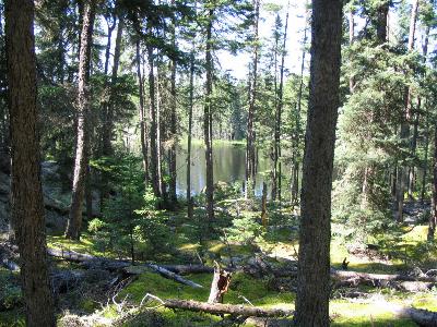
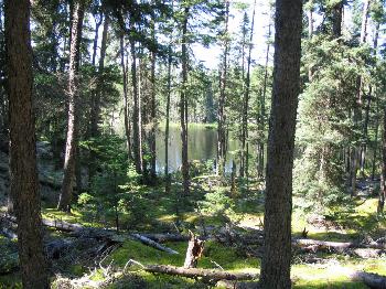
A lunch stop was made on Kennedy Lake which is a real jewel hidden away on the route up Royd Creek. On an exploration after lunch, my travels took me north and then east through the large center section to a channel that allowed me to get to another lake. The southeast end of this body was close to Royd Creek again and an old portage was found across to the creek. It came out on Royd Creek across from the 20-meter portage. My first lost portage of the trip and it was reassuring in how easy it was to travel. Two short portages later and camp was set up at the old fisherman’s cabin near Royd Creek. A fair amount of time jigging a Kastmaster at the spot my partners had lucked into some Lake Trout on our fly-in a few years back did not produce any supper.
To get my wife’s permission for this trip a satellite phone had to be added to my gear. By asking around it was found the best system for the area was a Globalstar satellite phone. A like new Quallcom 1600 was purchased on E-bay and service was obtained from a company because they offered an emergency package that allows me to pay $30 a month and $2 a minute of use for the U.S. and Canada. After packing the canoe and heading out on the open water, it was a simple matter of punching my home phone from the preloaded list and then "send" to make contact with the outside world.
Two portages north of Royd, camp was set up on the north end of the lake with the 20-meter portage. Now the real fun could begin since my goal now was to find a route to Irvine Lake. Ideally, a route all the way around the "O" of CARIBOU on the park map could be found. My plan was to leave my camp here, as the exploration straight north to the high top boot shaped lake was undertaken. To help readers this lake will be referred to as "Boot Lake." Anytime a lake name is in parentheses, it will mean that I have put a temporary name in for that lake. I have done it only to make the journal easier to understand. Some of these lakes may have traditional names that are not on the maps.
Once a route is found that far, a retreat will be made to "20 Meter Lake." My exploration will then be to find a route northeast to Irvine from near the 375-meter portage from "20 Meter Lake" to Bluegreen Lake. Bluegreen is not marked on the map but is a common name for this lake. Be there when the light is right and you will understand. If Irvine can be reached, Larus Creek can be used to go west over the "O" and then travel would be down the west side of the "O" to complete the circle back to the "Boot Lake."
 |
 |
| Portage Start from "20 meter" Lake | On the portage from "20 meter" Lake |
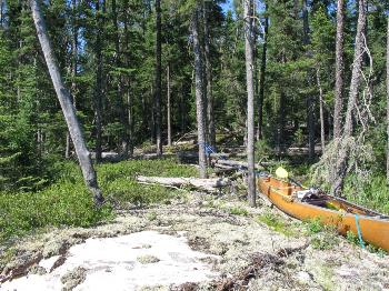
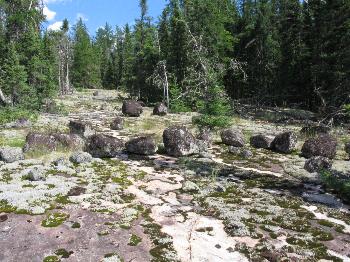
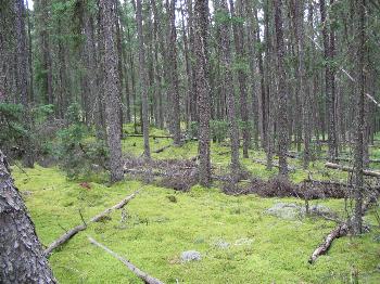
In the middle of the afternoon, the topo maps were studied one more time and the adventure was started. A nice rock shelf provided a nice start to the portage in an otherwise boggy shoreline. The GPS was the most important piece of equipment for this aspect of the search. With Canadian Topo maps loaded, the position icon showed my exact location on the map screen on the trek to the next lake. The terrain had some blowdown at first but then entered an area of open rock. A detour around a small bog added some distance but kept the portage on solid ground. A nice flat rock on the next lake provided another nice portage entrance. On the way back, my eyes were on the lookout for any better passages to follow. During the entire trip, it would be found that every trip across a portage would turn up a little better way of doing it.
 |
 |
| End of the portage from "20 meter" Lake | The split rock of Split Rock Lake |
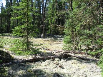
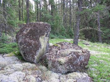
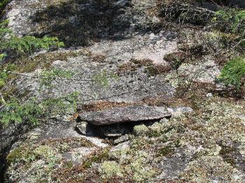
The next day the canoe was carried across and the exploration to "Boot Lake" continued. The first lake from camp has many interesting rocks. One is a large boulder that has been split cleanly in two. One half forms the chair seat and the other the back. From then on, the lake became "Split Rock Lake." There was evidence of use at least 30 years ago. Semi modern items like a Sunkist Orange pull-tab can. Possibly older was a rock seat fashioned on the side of a sloping boulder. Another old campsite showed signs of many trees having been cut down and left.
 |
 |
| The shore of Split Rock Lake | Old "rock seat" on the shore of Split Rock Lake |
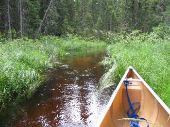
A small stream that looked like it had been cleared of rocks provided easy access to the next small lake. If the water dropped to half of what it is a canoe will still have no trouble getting through the sandy-bottomed stream. The afternoon was spent scouting a route on the east side of the creek leading to "Boot Lake."
 |
 |
| Open creek leaving Split Rock Lake | Portage to "Boot Lake" |
A fun time was had but in the end, the ravines forced the route so far east that a return was made the next day to lay out a better portage on the west side. The final route starts with a climb but then is a nice walk through the forest. A small stream comes across the route but is down in the rocks at the best crossing spot.
Copyright by Martin Kehoe, March, 2006 http://canoestories.com/kehoe/irvine1c.htm