 |
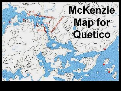
Slide 1 If you've traveled
in the Boundary Waters Canoe Area or in Quetico
Park, Ontario, you're probably familiar with
Fisher or Mckenzie maps. They show details like
portages and campsites, they're easy to read, and
they're waterproof. When you're in your canoe, campsites and portage landings are easy to spot, even from a distance. The worn, brown shoreline stands out from the green of the forest. These maps are good for navigating with a compass, but they don't contain the Universal Transverse Mercator Grid or latitude and |
| longitude reference points. There's no way to correlate a point on the map with a reading on your Global Positioning System (GPS) receiver except by going to a place shown on the map and taking a reading. McKenzie and Fisher maps are not available for Woodland Caribou Park. |