A Garner Lake Entry
|
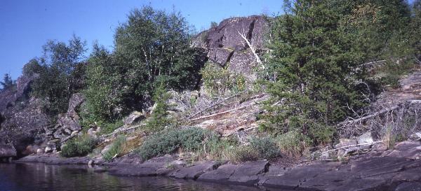
The next morning the camp came to life slowly. Since it was a rest day there was no urgency in doing anything. Ken was getting ready to take his son Ethan out fishing. His older son Josh was reading a book and my nephew Ryan was still sleeping. As they were getting ready to go out fishing I threw a DarDevle lure out in front of our camp and brought in a nice eating size Northern. Our fishing was off to a good start for the day. One more was caught and released from camp and Ken and Ethan turned four more loose from the canoe. Josh may have caught more from camp but he snagged a rock and while getting it loose he lost his footing and ended up going in with a loud splash. It was getting near swim time anyway and he didn’t get hurt. There was a steep bluff a little west of our camp and we hiked and canoed over there to climb it. Up on top the surface was broken with crevasses. Many of these were one to two feet wide and about 15 feet deep. We had to use caution as we moved around the area. One crevasse held the bones of a moose that had slipped to a horrible death. The bluff provided a very nice view of the country. This area had burned recently but was still really nice. With all of the barren rock on the bluff we were able to hike back to our camp without too much brush busting.
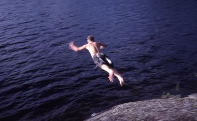
The boys then took a canoe out to play. The play consisted of swamping it and then learning to empty it of water and climb back in. After this the canoe became the water toy of choice for the rest of the trip. Later when we would return with it smelling of fish it was a simple matter of turning it over to them for cleaning. The clouds were building up and looking like rain so I put up some tarps and soon put them to good use as a shower started. A
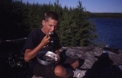
fish fry was on the evenings menu board so we set
about fishing again. With some effort we put four
on the stringer and that was found to be the
right number for our group of five. I was showing
Ken how to fillet a Northern and get the Y bones
out when I stumbled onto a little easier
technique than I had been using. The method
worked and allowed us to really enjoy our fish
frys. To fix the fish I used a quart sauce pan
that I had packed in with it half full of Crisco.
I put a thermometer in the heated oil to know
that it is hot enough and just as importantly to
make sure that we do not overheat it. With the
fish cut into small pieces We had just spent a very restful day on Jester so I did not feel bad about rousing everyone at 7:00 on Thur. morning to begin our push up to Haggart Lake. Breakfast was postponed until we had a few hours of paddling and portaging behind us. This was done to provide a nice long break in our days toil. I set off as the others finished loading their canoes and went across the 60 meter portage going north out of Jester. I hauled my pack and pail over first only to discover that with the present water levels all we really had to do was lift our gear over a small rapids at the start of the portage. We had 11 portages ahead of us today and it was a nice start to breeze through the first one. Our passage was going through some beautiful country. Especially nice was the stretch above the 30 meter portage. We would try to get a canoe on its way to the next portage as soon as possible so that they could be unloaded and out of the way before another canoe pulled up. We had so many short portages today that I took a little time early on encouraging everyone not to work harder but to portage smarter. Taking gear out of the canoe and transporting it directly to the end of the portage is a real energy saver. Often times gear is unloaded and hauled a short ways up the bank and dropped in a pile. Then hauled to the other side in a haphazard fashion and dumped in another pile and finally picked up again and put in the canoe. Much easier to haul directly to the other side and ideally the canoe is right behind you and can be set in the water and the packs never have to hit the ground. Every portage is a little different but with a little planning the loose ends can also work themselves out. Our crew caught on to the concept and from then on the portages were not thought of as death marches.
We were having no trouble finding the portages until the 80 meter one. It was right where it was supposed to be but we just did not see it the first time. When I have trouble finding the portage it is almost always my fault. Once I find it and compare it to the park map I find that usually it is right where it is shown. Often times my problem is not keeping the map turned so that North is really North. The compass on my life vest allows me to keep the map in a position that is in line with the lay of the land. Then when I glance at the map and look up everything fits. It may be a bay on my left and a point of land on my right that allows me to see my position on the map. Keep track of just where you are and it is a lot easier in the long run. At the last set of portages into Haggart the park has cut a 400 meter portage on the south side that can be used instead of the two 80 meter portages. At times there is not enough water to use the 80 meter option. We tried using both options and with the abundant water held up by a beaver dam during our visit the two 80 meter portages were the best option. A lot of what I am writing here is with hindsight. When we arrived the western end of the second 80 meter was hidden by a fallen tree and the new 400 meter had seen so little use that we had a hard time picking out the proper path and staying on it. I came back later to work on the 400 meter portage and by cutting some down trees and clearing away some smaller spruce trees the trail is now easy to follow. Once I removed the down tree on the second 80 meter that route was the easier option as long as the beaver dam has the water backed up. If you follow the South shore until you get to the beaver dam and then go to its North end you should be able to spot the second 80 meter portage.
It was such a nice evening that I left the camp for a solo paddle to the North end of the Haggart arm we were camped on. There were Broad-winged hawks and Loons to entertain me as I searched the shores for the sought after caribou. The sun had set as I returned to camp two hours later. Our selected campsite had everything we desired. With the way that Josh, Ethan and Ryan enjoyed the water this site excelled. Good deep water with easy exits out of the water for their frequent reentry’s. The view suited me well with nice scenes on the three open vistas the point provided. We would never be windbound with the three exits from the area. The site has been used enough that there are plenty of prepared tent pads. After exploring the surrounding area during our stay I found good campsites to be in short supply. Most of the lake shore rose sharply from the water and did not provide many shelves suitable for a camp. One exception was an area two miles southeast of our camp. The UTM coordinates of our camp were 15 U 356450 5639000. Friday, our first day in this camp was a lazy one. Everyone was still recovering from all the portages the day before. There was a swim after breakfast but then it was nap time. Ken and I went out fishing for supper. We tried for Lake Trout in the 40 feet of water in front of our camp but ended up taking more Northern Pike from some structure consisting of rounded rocks extending from shore and sloping out into the lake. These rock fields were made up of rocks about a foot in diameter. This type of structure never failed us as we trolled spoons over it. There were times that it took longer to fillet supper than it did to catch it. One of the many good reasons to drive a little further for your next canoe adventure.
Ryan and I went out in the narrow channel east of camp to give him some practice on paddling from the stern position. On the way back to camp we climbed some high rocks along the channel’s north bank. Back in the camp I joined in the swim for a while and then went to the tent for a nap. We were cleaning our fish on the shore about one third of a mile north of our camp to keep our camp clean and odor free. The eagles were dining but Ken noted that the Turkey Vultures checked it out but it was still too fresh for their refined taste. Small storm clouds had been leaving us alone all day but after supper one came in from the north and we had thunder, rain and wind for over an hour. Everyone then went to bed and the storm was out of the area by midnight. |
 I cook five pieces at a time. I coat
the pieces lightly with a dry fry mix. Depending
on the thickness the cook time is two to three
minutes. The pieces are set on a paper towel to
drain and then eaten while they are still fresh
and hot. When the pan has cooled and set up it is
put away until the next fish fry. I carry
additional Crisco in a lexon bottle and add a
little replacement as needed. We take care to
keep the pan upright when traveling as the Crisco
will start to run when the days are hot. Dessert
was a Jello NO Bake called Cookies and Creme. An
oreo cookie treat that is really popular with
everyone. By using freshly filtered water right
from the lake we had no problems with our
puddings and mixes setting up.
I cook five pieces at a time. I coat
the pieces lightly with a dry fry mix. Depending
on the thickness the cook time is two to three
minutes. The pieces are set on a paper towel to
drain and then eaten while they are still fresh
and hot. When the pan has cooled and set up it is
put away until the next fish fry. I carry
additional Crisco in a lexon bottle and add a
little replacement as needed. We take care to
keep the pan upright when traveling as the Crisco
will start to run when the days are hot. Dessert
was a Jello NO Bake called Cookies and Creme. An
oreo cookie treat that is really popular with
everyone. By using freshly filtered water right
from the lake we had no problems with our
puddings and mixes setting up.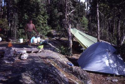 There is an excellent camp site a
half mile north of these portages and it would be
our home for the next three days. We had a simple
supper of Dinty Moore meals and minute rice bags
of rice. It is simple in that you just put the
microwave meals in boiling water along with the
bags of minute rice for 10 minutes and supper is
cooked. A nice thing after a long day of travel.
A batch of chocolate pudding completed the menu.
There is an excellent camp site a
half mile north of these portages and it would be
our home for the next three days. We had a simple
supper of Dinty Moore meals and minute rice bags
of rice. It is simple in that you just put the
microwave meals in boiling water along with the
bags of minute rice for 10 minutes and supper is
cooked. A nice thing after a long day of travel.
A batch of chocolate pudding completed the menu.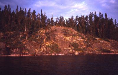 Saturday morning found me paddling
my solo canoe down the channel east of camp in
the moonlight. I was surprised to come upon some
canoeist camped a short ways up the channel. It
was the first human encounter of the trip. Before
sunrise I was three miles and a world away from
camp. I pulled up at the base of a 50 foot rock
and carefully clawed my way to the top to enjoy
the sunrise. The wind was blowing hard for 6:00
AM so I chose an arm of the lake going SE into it
for my next leg. I was able to stay out of it
most of the time and paddled on until I heard the
roar of water ahead. I was now at a stream in the
most southeastern arm of Haggart. The stream
dumped in over an area of those rounded rocks
that we had found so productive for fishing. A
mental note was made in case I am ever back in
the area and need a good meal. The early winds
had calmed and I had a leisurely paddle back to
camp in time for breakfast. The other campers had
moved on before my return so I still had not seen
a live person.
Saturday morning found me paddling
my solo canoe down the channel east of camp in
the moonlight. I was surprised to come upon some
canoeist camped a short ways up the channel. It
was the first human encounter of the trip. Before
sunrise I was three miles and a world away from
camp. I pulled up at the base of a 50 foot rock
and carefully clawed my way to the top to enjoy
the sunrise. The wind was blowing hard for 6:00
AM so I chose an arm of the lake going SE into it
for my next leg. I was able to stay out of it
most of the time and paddled on until I heard the
roar of water ahead. I was now at a stream in the
most southeastern arm of Haggart. The stream
dumped in over an area of those rounded rocks
that we had found so productive for fishing. A
mental note was made in case I am ever back in
the area and need a good meal. The early winds
had calmed and I had a leisurely paddle back to
camp in time for breakfast. The other campers had
moved on before my return so I still had not seen
a live person.| Go
to Part: 1 2 3 4 |
More Canoe Stories |
Maps for this trip |
Part 4 |
Copyright 2002 by Martin Kehoe - http://www.canoestories.com/garner1c.htm